
Guide
How do you check the sun conditions on a home?
There are four ways, and they answer different questions. We have tried all of them on real addresses in Oslo. Below is what each one actually gives you — and where they stop.
The short answer
If you want to stand on the spot and see where the sun is right now, use a phone app. If you want to know how many hours of sun the home gets through the year — December included, without going there — you need a lookup that counts the building next door and the trees. Most of the advice you find online stops at “download an app”, without saying what the app cannot answer.
1. A phone app, on site
Apps such as Sun Surveyor lay the sun's path over the camera image while you stand there. It works well, and the Norwegian estate agents' own association recommends it. But the app answers “is there sun here now, where I am pointing”. It cannot tell you in March what the balcony gets in December, and you have to be physically present for every home you are considering. The full version costs money; there is a free light version with fewer features. Looking instead for a sun-conditions app that computes the whole year without a site visit? Soltreff itself installs straight from the browser.
2. The sun tab on Finn
It sits inside the listing you are already reading, and it is free. It draws the sun's path over a horizon line and states hours of sun. But read what Finn writes themselves: the calculation “does not take vegetation, buildings or nearby terrain into account”. The horizon is terrain only — hills and ridges far away. The building next door that actually takes the evening sun is not in it. You cannot choose a day either — you get four: spring, summer, autumn and winter.
The figure is therefore a best case, not what the home gets.
3. 3D tools
Norkart and Easy Eiendom draw the address as a 3D model where you can drag a timeline and watch the shadows fall. Easy Eiendom is free. Norkart has put its tool behind a login and sells access for 99 kroner per property on e-Torg. Norkart includes trees in the largest cities — generated automatically, and in their own words “not an accurate representation of reality”. Easy Eiendom writes that its simulator shows “approximate shadow patterns” and does not include vegetation.
The problem is not the model — it is good. It is that you get a scene, not an answer. You have to find the address, turn yourself the right way, drag the timeline and judge what you see for yourself. To compare two flats you have to do it twice and trust your memory. Neither gives you a figure you can write down. Norkart's trees also keep their leaves all year, 21 December included.
The same goes for Google Earth, which many people try: you see sun and shade in 3D, but you read it off yourself, and nothing adds the year up for you.
4. Look the address up
A lookup is the only way to get a figure without travelling to the home. But two lookups can calculate very differently, so check what is in the figure.
offentligdata.no, for instance, shows sun figures for any Norwegian address, free — sunrise, sunset and “direct sun” in hours. But the figure is worked out against the terrain alone: the service states itself that the shadow is calculated “from mountains and hills based on elevation data”. Neither neighbouring buildings nor trees are in it, so “92 % of theoretical” can stand at an address where the building next door takes the whole evening sun. It is the same limitation as the Finn tab — with a more confident figure.
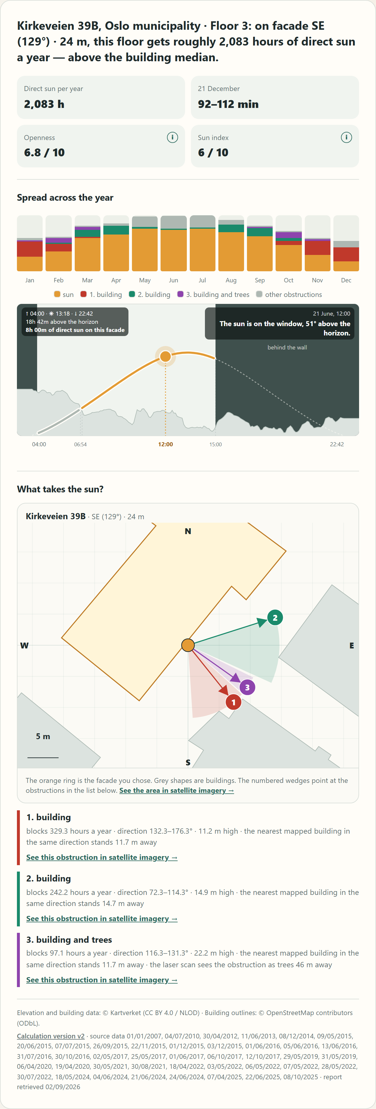
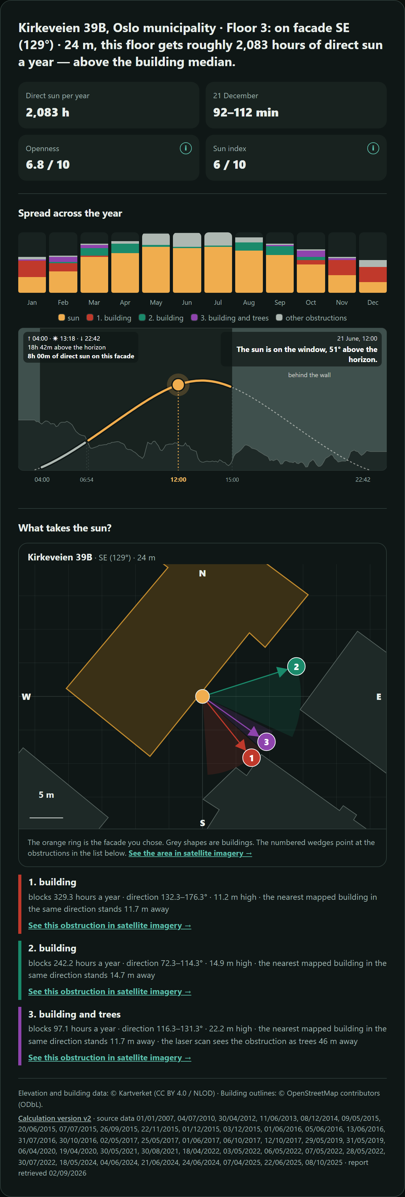
Soltreff counts the obstructions. You type in the address and get hours of sun through the year for that floor and that facade — with neighbouring buildings, terrain and the trees that actually stand there counted in. December is stated as a minimum figure, because we do not know whether the tree is deciduous or a spruce, and we would rather say so than dress the figure up. Free, and Oslo, Bergen, Trondheim, Stavanger, Kristiansand and Akershus for now.
The tools side by side
| Tool | Counts buildings and trees? | Gives you a figure? | Price |
|---|---|---|---|
| Phone app, on site | Whatever you point at | No — you read it off yourself, there and then | Full version costs |
| Finn sun tab | No — distant terrain only | Hours over terrain, four days a year | Free |
| offentligdata.no | No — terrain only | Yes, but with no buildings or trees in the sum | Free |
| Norkart 3D | Buildings yes, trees in leaf all year | No — a 3D scene you interpret | 99 kr per property |
| Easy Eiendom 3D | Buildings yes, vegetation no | No — “approximate shadow patterns” | Free |
| Soltreff | Yes — both, plus sheds and walls the map is missing | Yes — hours per year, and a minimum figure for December | Free (six areas) |
What to look for, whichever tool you use
Three things almost always decide the answer, and two of them are easy to miss.
December, not June. In summer the sun is high and most homes get sun. The difference between two flats is largest when the sun is at its lowest. A tool that only shows the summer hides precisely what you want to know.
The floor and the facade. A second-floor flat facing the courtyard and the top floor facing south are two different homes in the same building. Check the figure for that home, not for the property.
The tree, not just the building. The estate agents' own association points to the neighbour's tree as the most common reason the sun does not turn out as promised. A building is on the map; a tree often is not.
We cover Oslo, Bergen, Trondheim, Stavanger, Kristiansand and Akershus for now, plus parts of neighbouring municipalities. The rest of Norway is coming.